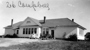
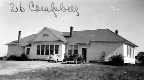
I have been hesitant to post about Campbell School because I don’t really have anything to post. One night, while searching the South Carolina Archive & History website, I found this picture from a file of insurance photos taken of schools between 1935 and 1952.

My grandfather, a descendant of the John Campbell who settled in Abbeville County at the very beginning of the nineteenth century, grew up on property labeled as Campbell’s Mill on the 1820 Mills’ Atlas map of Abbeville County, South Carolina. John Campbell’s daughter, Arabella, married Thomas Pleasant Martin and the property later became known as Martin’s Mill while it was under the ownership of their only son, John Campbell Martin. I am tempted to get bogged down in Campbell genealogy here, but need to resist for the sake of brevity and making breakfast. To keep it brief, John Campbell had a pile of daughters but I cannot find any mention of a son. The area where he lived is populated with people carrying the Campbell name though, so my working hypothesis is that he either brought a brother with him or moved to Abbeville because he already had family in the area. His brother, Archibald, seems to have come to Abbeville with him but I think there is much more to it. In the area between the towns of Abbeville and Lowndesville, the Nations area, the Campbell family has had a large presence for the past two hundred years or so. It’s something I will certainly dig into more in the coming months.
So here’s this school. It’s long gone though, right? Disassembled, carried away, leveled and left for the cows, right? Nope. While in Abbeville, I struck up a conversation with a long time volunteer of the Greenwood library’s genealogy room, who told me that I really had to take Nations Road down to Lowndesville. My husband was driving and I was staring out the window when I saw, through thick and purposeful bushes, a strange building with a tall roof and a strange shape. I had kind of assumed that a search for the original location of Campbell School would be, even if fruitful, totally pointless. What was I going to do, go stand in a field and ponder how something neat use to be here? But there was that building, though the bushes, along side the road. Now clad in dark wood siding, it was no longer a public building, but someone’s private property.
A search on the website for The U. S. Board of Geographic Names turns up a profile page of the location. It looks like the only USGS topo map that it ever appeared on was the page for Latimer (SC) in 1938. Nothing earlier, nothing later… and that map doesn’t seem to be available.
That is really all I have, but I wanted to put it all in one place for now until there is more. My best lead right now is actually someone who owns an adjacent properly. I sent them a Facebook message after misreading the Abbeville GIS map. Being a goober might pay off though because she is going to send along a couple of names of people I should talk to in the area. The local historical society doesn’t have anything on it, nor do a couple of area historians I’ve written to. It all seems like a fool’s errand, I guess, but this building is really fascinating to me. I’ll be sure to report back if I find out anything more.
This past October, I was in the area and actually told my husband that it would be quite a while until we came back. It’s not that it isn’t all interesting and a nice place to visit, but we can only make so many trips and it was a little ridiculous that South Carolina accounted for three of them in one year. I may be eating my words though. As we are expecting our second child in August, I might want to gather my notes and make another run at it in the spring before I’m grounded for another bit of time.
